It’s no secret that Big Sky’s water resources are fragile. Water quantity and quality are heavily dependent on a deep winter snowpack and large rain events in the spring, summer, and fall. This precipitation recharges our groundwater resources. As summer wears on and precipitation decreases, aquifer levels drop, but then fall rolls around and the snowpack builds again, stockpiling water in the form of snow that will melt come spring, continuing the perpetual cycle.
Even small changes in weather patterns, climate, and usage can disrupt this balance. Across southwest Montana, climate scientists predict rising average temperatures that could lead to a decrease in average snowpack. Scientists also predict increases in the speed and duration of runoff, meaning water would rapidly leave the watershed, potentially leaving our aquifers without adequate recharge.
However, the biggest observable change so far has come in the form of usage and land development impacts on water quality. There are far more people living, visiting, and recreating in our headwaters community than there were even a decade ago, and all these people use a lot of water, and produce a lot of wastewater.
“Large groundwater withdrawals can affect stream flow by intercepting water that would return to the stream as springs,” said Mike Richter of the Montana Bureau of Mines and Geology. “These springs are critical to maintaining cold base flows in late summer. Additionally, increasing numbers of septic systems add nutrient load to this shallow groundwater system. Combine these two effects and we are more likely to see impacts to our river, including harmful algae blooms.”
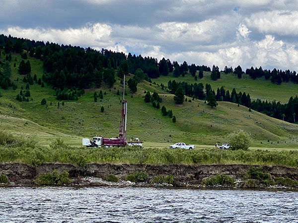
One area of particular concern is the river corridor between Highway 64 and Beaver Creek. The canyon, as it’s referred to by locals, is poised for significant development relative to what we have there now. To better understand water quantity and quality in this area, the Montana Bureau of Mines and Geology (MBMG) has launched a Ground Water Investigation Project, or GWIP, that started this summer and will continue over the next two years.
The goal of this project is to “assess the cumulative effects of existing and future residential and commercial development on water quality and quantity,” according to James Rose of MBMG. The project also hopes to gain knowledge of the groundwater to surface-water relationship in this area. Where does the river lose water into the aquifers and where does the river gain flow back? “This is critical to understanding what the recharge sources are to the aquifers, especially the shallow aquifer under this area that is seeing increasing nitrate trends,” Richter said.
Project researchers will collect groundwater-level data, measure surface-water flow in the Gallatin and adjacent tributaries, sample groundwater and surface-water chemistry, and install monitoring wells. Based on what they find, we’ll gain knowledge of the area’s aquifers and how closely they are tied to the Gallatin River.
“We know our water resources are fragile, and we know more development and increased populations are inevitable,” Gallatin River Task Force executive director Kristin Gardner said. “To plan for that inevitably, we need hard data that will tell us what’s possible, without compromising the Gallatin River.” To gather that data, the Task Force submitted the canyon area to the GWIP program. “Understanding the canyon’s capacity is critical to making sound management and development decisions,” Gardner continued.
At the end of the study, researchers hope to have a water budget, or a comprehensive accounting of how much water flows in and out of the study area. They’ll also be able to map how future septic systems could impact surface-water resources. Understanding how groundwater flows, how much there is, and its nutrient make-up are all essential for determining future threats and making wise land- and water-use decisions.


