
Those of us who like to play outside in the winter have spent valuable time bemoaning the current snow situation. In addition to complaining about snow scarcity, we should take a moment to worry about the future of water as well. High elevation spring snowmelt feeds between 50-80% of Montana’s annual water supply. Thus, spring runoff drives our ability to fish and paddle the Gallatin.
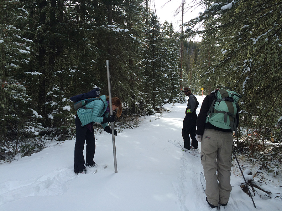
Fellow Big Sky Watershed Corps members and an NRCS employee measure snow depth and mass at Four Mile Snow Course in order to calculate snow water equivalent.
Westerners have long understood the relationship between high mountain winter snowpack and summer water supply. Snow melt runs directly into rivers and lakes or percolates into underground aquifers, which contribute to stream baseflow when the mountains are dry.
Since the 1930s, the USDA-NRCS has manually monitored snowpack at sites known as snow courses in order to forecast water availability. NRCS employees and volunteers maintain 2 snow courses in the Upper Gallatin and 4 in the Madison Range. Last Tuesday, I participated in a monthly monitoring event at Four Mile Snow Course just west of McCallister in the Tobacco Roots. We measured an average snow depth of 5.2″, 82% of the 30 year average of 6.0″, which was better than expected.
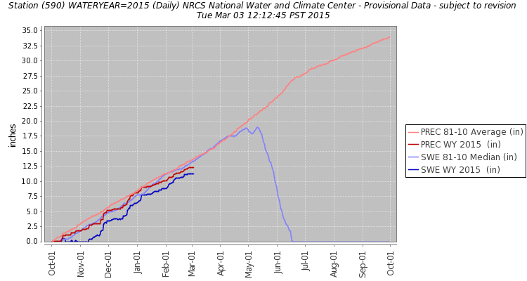
Precipitation (PREC) and snow water equivalent (SWE) data from the Lone Mountain SNOTEL station obtained from the NRCS website. The pale pink (PREC) and pale blue (SWE) show the thirty year average, while the red (PREC) and dark blue (SWE) show current measurements from October 2014 to March 2015. The data suggests that the Lone Mountain SNOTEL site is at 87% of average.
Since the 1980’s, technologically advanced SNOwpack TELemetry (SNOTEL) have recorded and transmitted near real-time snowpack data. SNOTEL stations measure snow water content, snow depth, and temperature. Data from these automated stations, available on the NRCS website, has greatly improved our ability to predict water availability. The spring water supply outlook is more encouraging than one might initially expect given the recent below normal precipitation and warm temperatures.
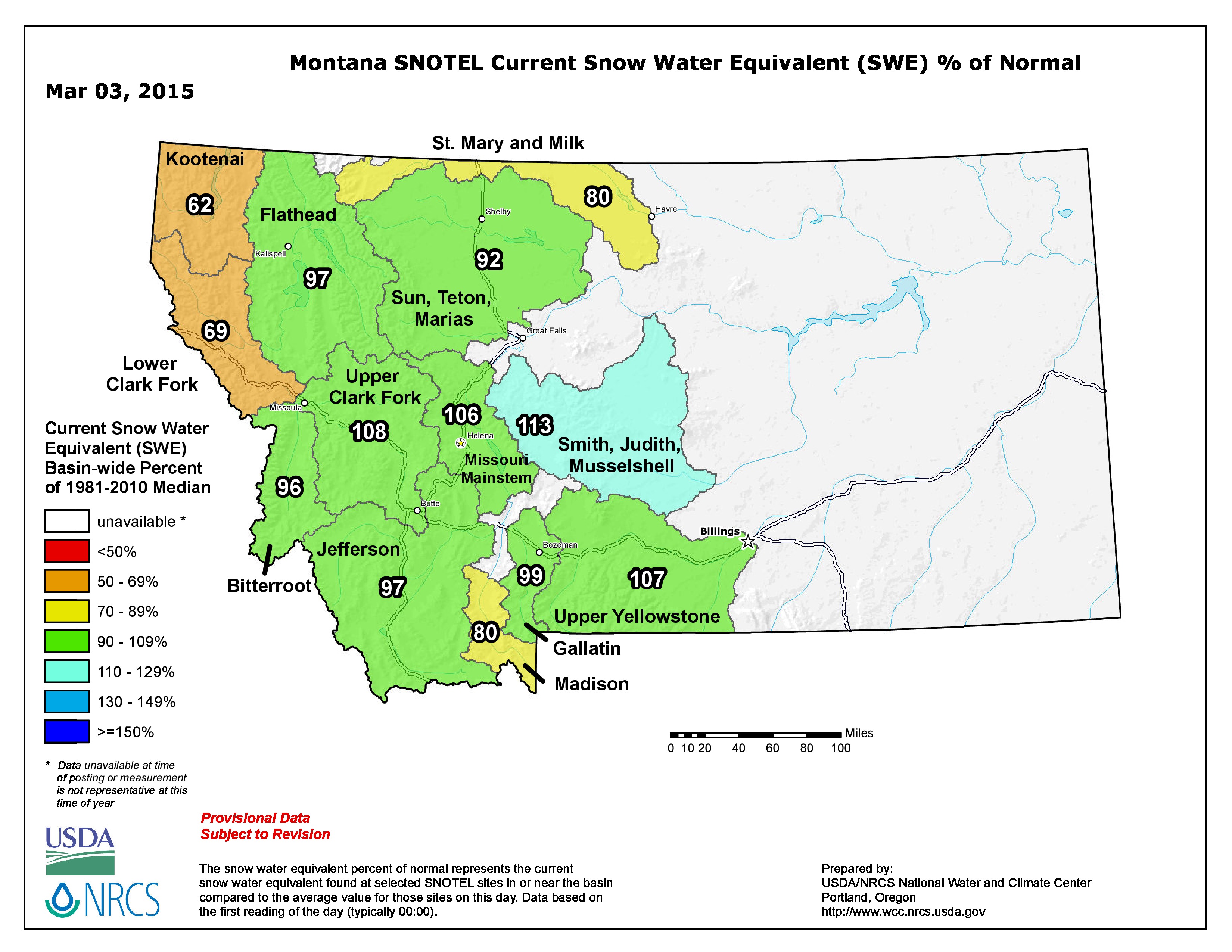
Map of Montana comparing the snow water equivalent for March 3rd to the 30 year “average”. At between 90-109% of normal, the snow water equivalent in the Gallatin is near average.
Early season snowfall and carryover flow from last year will augment runoff, helping to make up for the warm and dry “Juneuary”. In addition, the amount of water in snow, and not just snow depth, is important when it comes to forecasting spring water availability. Although snow conditions haven’t been ideal for skiing, our wet, heavy snowpack bodes well for runoff this spring.
Currently, the snow water equivalent in the Gallatin Basin is at 99% of average. The forecast for water supply, as of February 1st, suggests that water supply will be “near normal” (91-110% of average). SNOTEL sites aren’t a perfect instrument for predicting runoff, but they are still the best tool that Western water forecasters have at their disposal.
Although the powder days have been few and far between this winter, the current forecast suggests near normal water supply this spring and summer.
For more information on future snowpack monitoring events in the area, contact: stephanie@bluewatertaskforce.org.
For more detailed information on water supply, consult the NRCS website or these NRCS documents: